A Shared-River Reading Afternoon
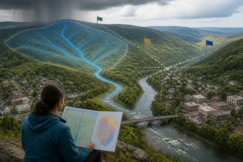
A shared-river reading afternoon uses free maps and place names to trace how upstream choices connect with downstream communities across borders.
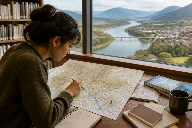
At a library table, a student opens a free map and traces a blue river across a border. A shared-river reading afternoon can turn that ordinary map search into a close look at how places, languages, resources, and environmental conditions connect upstream and downstream. The plan needs only a public map, a few reliable descriptions, and enough time to follow the river’s names and neighboring places without trying to explain how its water is managed.
The central idea is to read the river as a line joining many lived places, not as a subject to master. A map offers geography; place names offer clues to language and memory; public descriptions add context about what people depend on and notice. Read together, those materials help a reader ask better questions about connection without pretending that one afternoon can settle disagreements or reveal every community’s perspective.
Choose a river with a visible cross-border path
Begin with a river that crosses an international boundary or forms part of one. Choose a stretch with several named settlements, tributaries, or major geographic features, since these give the reading a natural sequence. A public map from a library, a national mapping agency, or an open mapping service is enough to begin. You do not need a specialist atlas or an account on a paid platform.
Use the map’s search box to find a river, then follow its course in both directions. A tributary is a smaller stream that joins a larger river. Mark where tributaries meet the main channel, where the river approaches or crosses a border, and where towns or cities appear nearby. Keep a scrap-paper sketch if the screen makes it difficult to hold the whole route in view.
For this session, set a modest boundary: follow one stretch from a recognizable upstream feature to a downstream settlement, or from one border crossing to another. A river may run far beyond the area you can explore in an afternoon. Limiting the map keeps the exercise focused while leaving room to notice that the selected stretch is part of a larger system.
Follow the names as clues, not conclusions
Write down the river’s names as they appear on the map. Check whether the same river has different names in different countries, languages, or sections of its course. A name may reflect a local language, a historical naming convention, or a difference in how maps label the waterway. A map alone cannot tell you which explanation applies, so treat the name as a prompt for further reading rather than a complete account.
Look next at nearby place names: towns, valleys, bridges, wetlands, and tributaries. Notice whether a map shows alternative spellings or names in more than one language. These details can suggest that a river landscape is shared by communities with different ways of describing it. They do not tell you how residents identify themselves, and they should not be used to guess what a name means without a dependable source.
Try a public library catalog, a local government page, or a museum’s online material to find a short explanation of one unfamiliar name. Prefer a page that identifies its publisher and explains the place in its own context. If no clear explanation is available, leave the name unresolved. Keeping uncertainty visible is more respectful than turning a guess into a fact.
Build a simple upstream-to-downstream reading path
Choose three stops on the map: one upstream, one near the border or a major tributary, and one downstream. For each stop, find a public description from a local visitor office, regional organization, park service, library, or community group. The descriptions do not need to be long. A paragraph about a wetland, a town’s riverside market, a ferry crossing, or a local fishing tradition can show what people notice about a particular stretch.
Read each description with the same set of plain questions:
- What place is being described? Note whether it is a settlement, a natural feature, a crossing, or a working landscape.
- What connection to the river is named? The text might mention travel, food, recreation, local identity, habitat, or a view from the riverbank.
- Who is speaking? A visitor page, local organization, and government notice may each emphasize different things.
- What is left unsaid? A short description has a purpose and cannot stand for every person or issue in the area.
Put the notes beside the map in upstream-to-downstream order. Do not assume that the descriptions use the same language or describe equivalent experiences. Their differences may be useful: one place might present the river as a public space, while another emphasizes its role in local livelihoods or landscape. The aim is to notice those frames, not rank them.
See how upstream and downstream descriptions connect
Upstream describes a place closer to a river’s source; downstream describes a place farther along its course. Water, sediment, plants, animals, and human activity can link locations in these directions, though the relationship varies by river and by season. For a reading afternoon, the useful task is to identify the connection being described and ask what information would help explain it—not to infer a specific effect from a map alone.
Suppose an upstream public description mentions a riverside forest, while a downstream page describes a wetland where river water spreads through low-lying land. The map can show that the places lie along the same river system. It cannot, on its own, establish how much water or material moves between them, or how a particular change in one place affects the other. That distinction keeps a broad environmental connection from becoming an unsupported claim.
Public pages can also reveal different ways people relate to a shared river. A local page may discuss walking paths; a regional page may focus on wildlife; a town’s description may remember a bridge or crossing. Read these as partial views from particular places and institutions. Their variety is part of the exercise: a river can connect communities without making their priorities identical.
What should you look for on a public map?
How can you tell where a river crosses a border?
Turn on a map’s country or administrative boundaries, then follow the river where the boundary meets it or crosses nearby land. Compare the line with labels and physical features, because a border drawn beside a river may not follow the channel shown at every point.
What if the river has more than one name?
Record each name with the location and map or page where it appears. Check a local public source for context, and leave the meaning open when the source does not explain it clearly.
Which public descriptions are useful?
Choose material from a clearly identified local institution, public agency, library, park, or community organization. A useful page describes a place or relationship in concrete terms and gives enough context to identify whose perspective it represents.
Can a map explain what happens downstream?
A map can show the order of places, tributary connections, and nearby features, but it cannot establish the cause or scale of a downstream effect. Use it to frame a question, then look for a relevant public explanation rather than filling gaps with assumptions.
Try the reading afternoon as an invented situation
Say a fictional high school student chooses an unnamed river that crosses two countries and flows past a wetland. The starting point is a free library computer, a paper map, and no prior knowledge of the area. The student searches the river, marks a tributary and two settlements, and copies the place names as printed rather than guessing at their origins.
Next, the student finds three public descriptions: one from a town page upstream, one from a community organization near the border, and one from a downstream park. The student notes what each source says the river means locally, while also recording who published the page. The map is then used to arrange those observations along the river’s course, not to claim that one description explains another.
By the end, the student has a small annotated sketch, a list of names with sources, and a question for further reading: how do public descriptions of the river change from one place to the next? The expected observable result is a clearer account of what the sources say and where the student’s knowledge stops. No real river or community is being described in this invented situation; its value is the method of keeping map observations distinct from interpretation.
Keep the notes useful after the session
Make the record simple enough to revisit: a route sketch, a short place-name list, and a source note for each description. Write the publisher and page title beside each note so that a reader can find the material again. If a page gives no author or date, record that limitation rather than supplying details that are not present.
Use different marks for what the map shows and what a source says. For instance, a solid line can trace the river’s mapped course, while a small note can quote or paraphrase a local description. A question mark can flag an unresolved name or connection. This modest separation prevents an interpretation from quietly becoming a map fact.
If you share the sketch with a class, reading group, or family member, keep the sources alongside it and explain that the notes cover selected places, not every community along the river. Invite readers to add a public local source from another stretch, especially one that offers a different perspective. The goal is to widen the account carefully, not to make a single afternoon stand in for the whole river basin.
A shared-river reading afternoon works best when its final page contains both a route and a boundary around what is known. Maps help a reader see how upstream and downstream places belong to one connected course; names and local descriptions show that the connection is experienced and described in different ways. A well-marked question is a useful result: it points toward the next place, source, or voice to consult.